
An approximate view from inside the FDR Park ‘protest zone’ perimeter. Image: Google
By Dustin Slaughter
City officials released a map on Thursday evening detailing the layout for next month’s Democratic National Convention ‘protest zone’ at FDR Park. Below is the map and the Kenney administration’s statement in full:
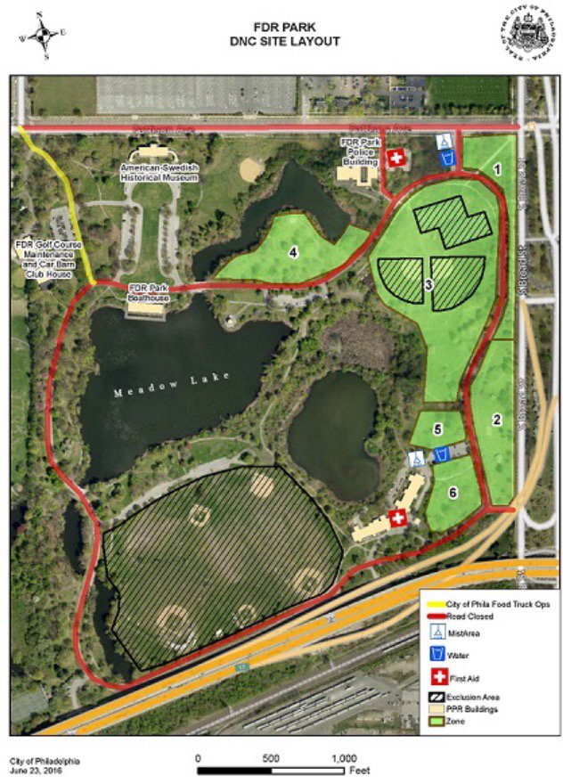
Today, the City released the layout of FDR Park during the Democratic National Convention. FDR Park will hold six permitted demonstration zones from Sunday, July 24 through Thursday, July 28. Demonstrators will have access to water as well as two misting and First Aid tents.
The roads outlined in red on the map will be closed the evening of Saturday, July 23, through Friday, July 29. Pattison Avenue will be closed to the public from 20th to 7th Street. Broad Street from Packer to Terminal will be closed to vehicular traffic with the exception of authorized vehicles. The sidewalks will remain open to pedestrians to allow access to FDR Park. The SEPTA Broad Street Line (BSL) station at Pattison will remain open.
Organizer Billy Taylor has applied for and been granted a permit for Zones #1, 2, 3 & 4 for July 24 through July 28. Zones #5 & 6 have not yet been permitted though applications have been submitted. Permits are issued on a first come first serve basis.
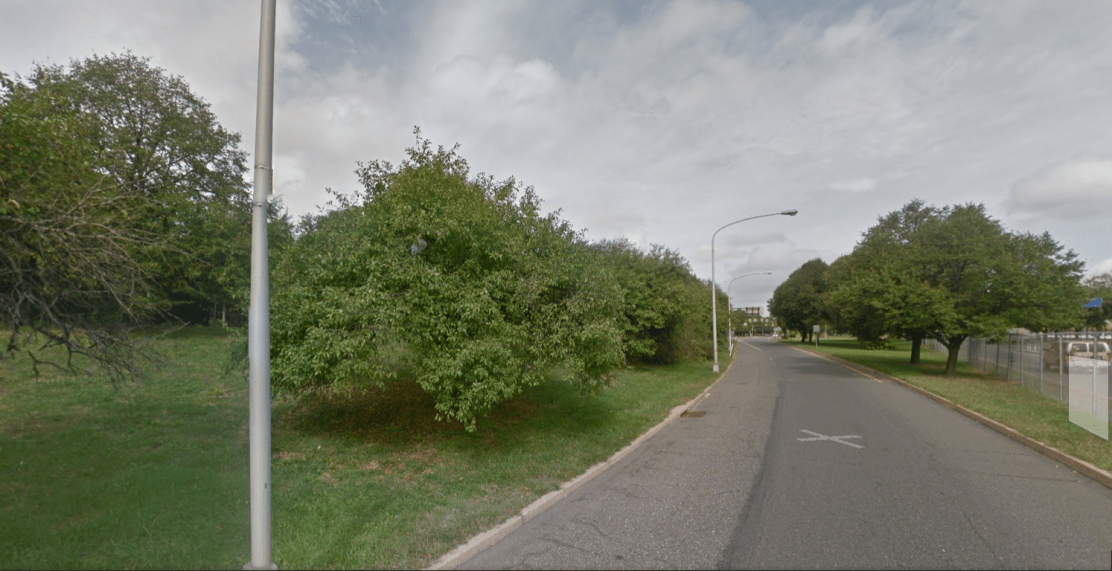
View facing north. The wooded area to the left is part of ‘Zone 2’ on the city’s map. Image: Google
“This map seems to confirm that protesters in many, if not all, parts of FDR Park that have been designated as ‘free speech zones’ will definitely not be visible or audible from the roadways or the convention site,” Molly Tack-Hooper, a staff attorney with the ACLU, told The Declaration Thursday night.
The ACLU of Pennsylvania filed a lawsuit in U.S. District Court yesterday on behalf of a group that was denied a permit to march down Broad Street on the convention’s opening day. Tack-Hooper said the FDR Park plan highlighted the need for the city to not restrict rush hour demonstrations in Center City, which was a fundamental argument in yesterday’s lawsuit.
“The DNC chose a really remote location as their convention site, and there really aren’t any ideal protest sites nearby where protesters can be seen and heard by delegates on their way into the Convention,” she stressed.
The group expressed their concerns in a letter to the administration last week over whether or not demonstrators would be allowed to camp in the park, as well as shifting administration stances on march permitting for Broad Street and throughout Center City.
Administration spokesperson Lauren Hitt told Billy Penn that protesters would be asked to vacate the park after 10 pm “due to health and safety concerns for prospective campers.”
If you enjoyed this story, please donate to the Declaration to support more investigative journalism like this.

If you cannot view our donate buttons because of your browser security settings, please donate here.

[…] officials released on Thursday a map of where within FDR Park protesters will be permitted to demonstrate from July 24th to July 28th during…. The park, according to the map included below, will be divided into six zones. A pro-Sanders […]
LikeLike