Editor’s Note: The Declaration is pleased to announce that we are being joined by planning and environmental reporter James Kennedy. You can follow him on Twitter @transportphilly. One of his contributions will be a column on the history behind the diagonal streets that cut through Philadelphia’s grid.
By James Kennedy
As children or as parents many of us encountered Diagon Alley in the Harry Potter books and movies. Philadelphians perhaps more than any other Americans can actually picture Diagon Alley: an ephemeral entranceway through the Leaky Cauldron pub, invisible to the eyes of non-magical people because they fail to pay attention to what’s around them.
Philly has lots of small wonders that pass unnoticed to the harried and jaded. Rowling’s place names and characters often clumsily signal their meaning (Lupin the werewolf, Umbridge the uptight scold. . . ) and Diagon Alley’s clunky double-entendre is that it says “diagonally”. This pun ought to speak to Philly residents particularly: Philadelphia is not a city of worn cowpaths like Boston, and its grid is older and more stodgily logical than the more famous one in New York copy-catted from William Penn.
The diagonal avenues, which break the mold of the city’s form are not tight side-alleys like many actual streets in our city, but stand as much chance of being ignored as if they were.
Schuylstraat
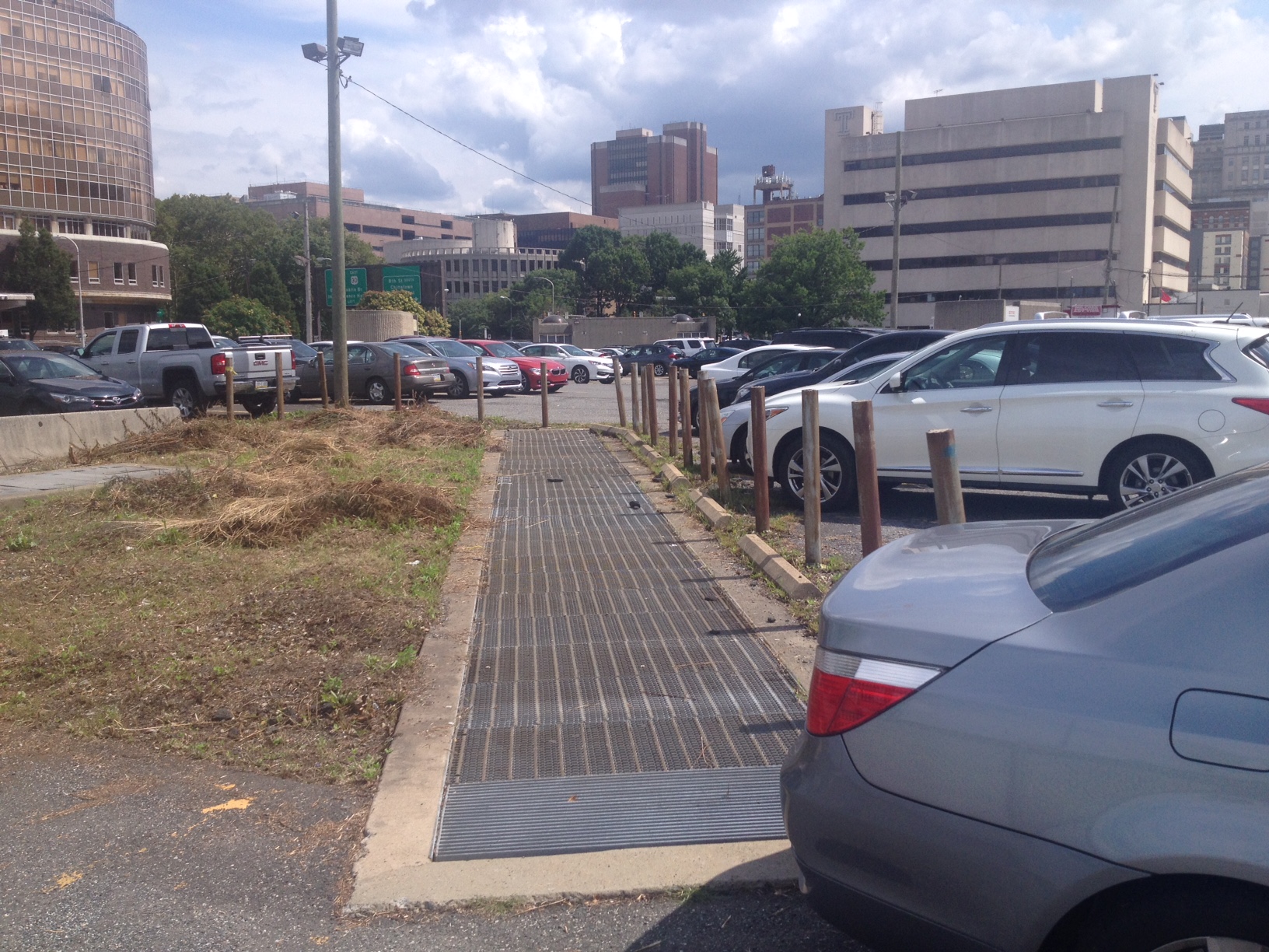
Ridge Avenue cuts diagonally off of Wood Street, itself a side street of 9th. Though the street is ample and in some places overbuilt, its back-street beginnings hearken to Philadelphia’s “hidden” river, the Schuylkill which it eventually parallels for many miles farther northwest.
Perhaps Ridge should have been called Schuylstraat, the hidden street, but the Dutch nomenclature wouldn’t make much sense since Ridge’s isolation is a 20th Century invention. On foot, the logical pathway to Ridge feels like it ought to be 9th Street, but the Vine Street Expressway doesn’t even have a 9th Street crossing.
Ridge’s isolation from economic activity has less to do with where its final block spills out than the Berlin Wall that is built against it. To walk to Ridge from Center City requires crossing the Vine Street Expressway at some of its most awkward points.
As if to underscore the point, Ridge has a prehistory (or posthistory, depending on which way one walks) underground through the Broad-Ridge Spur that connects 8th & Market on the El to Broad & Fairmount on the Broad Street Line. Only one stop, Chinatown, exists in between. Like a magical loose brick in a London wall, the Broad-Ridge Spur alerts the attentive to its existence through even the most barren of highway-adjacent surface lots because its grates rumble as the trains go past—the only noise that seems strong enough to overcome the alienating bluster of the highway scar.
A Travel Method with Some Punch
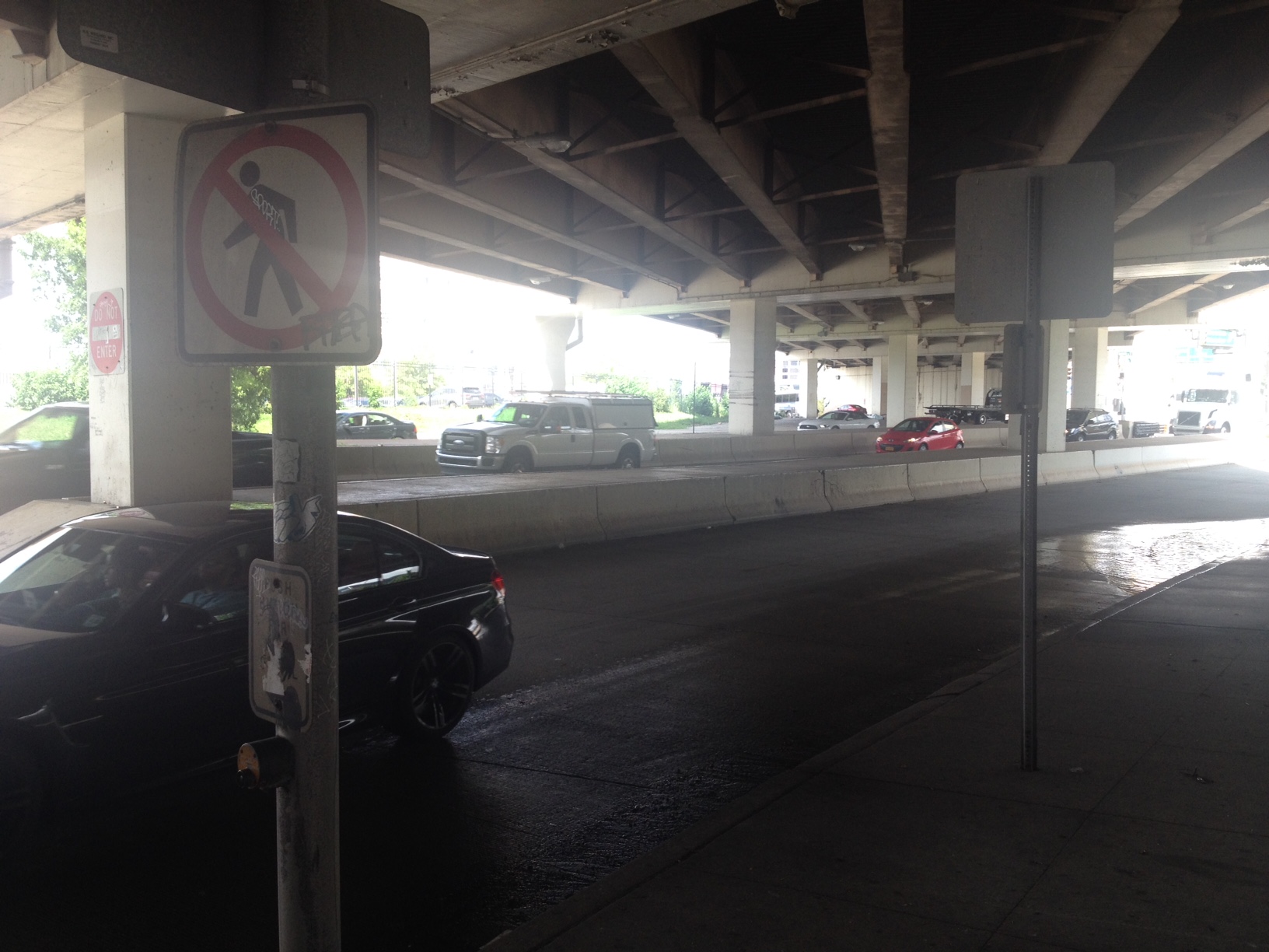
Steven Punch, a construction worker on his way back to Frankford from Camden, New Jersey, is walking below the 8th Street overpass, and stops to talk.
Punch thought crossing under the highway was made difficult by the blindspots for turning drivers. Unlike many Philadelphia streets which are narrow and built with sharp ninety-degree curves, the PennDOT-designed access-ramps allow vehicles to “whip around”, as Punch describes.
The proper planning goal would be the removal of the Vine Street Expressway entirely. Philadelphia is happily among the least-per-capita-highwayed cities in the country according to an analysis by blogger Patrick Kennedy (no relation) out of Dallas-Fort Worth, but none of the City of Brotherly Love’s forays into big roads—the Schuylkill Expressway, I-95, the Roosevelt Boulevard—have been a success. The Vine Street Expressway is no different: it takes away far more than it adds, costing the region development and requiring burdensome maintenance that could go to improving real connectivity between neighborhoods and the region.
Punch explains why walking makes sense to him, even with this unwelcome blockade: planners say that good transportation looks empty—think of a bus lane or rail line between arrivals—and bad transportation looks full. I-95, his other option, is always full because the cars that fill it up take far more space per passenger than any other mode.
Someday Philadelphians will convene on their urban highways and in one voice declare: Tear. Down. This. Wall.
Nobody Likes the Garbage (Even If They’ve Never Read Mickey Melendez)

At Ridge & Spring Garden a prospective Temple student, Luke, who only gives his first name, explains that he and his friends Grace and Alayna are “just here walking around the city.” Grace adds “We wanted to give food and money to homeless people,” an addition that feels abrupt, if well-meaning.
Luke, who seems the most positive on the experience of the three, nonetheless expresses his disappointment. “I kind of thought there would be more murals here to take pictures.”
Grace, who came to give food and money to homeless people, pipes in to say that “There’s a lot of trash” and though this, like her earlier statement, is abrupt, it’s not untrue.
The disconnection of the neighborhood from its nearby neighbors in Center City has had an impact on some of the streets, which are less cared for than is deserved. “It’s what I expected, it’s a city” adds Alayna.
Blaming the woes of the neighborhood on the highway seems fanciful until one remembers that a natural experiment exists right in the same city. South Street was slated for the same demolition that Vine Street received, its home and business values plummeting precipitously in the 1960s in expectation of a crosstown expressway that never came.
The street today holds few cars, and none of the cars that are there moving quickly, but the combined flow of bus riders, bicyclists, and pedestrians is more than the largest street could hold if each were behind the wheel. And at a sliver of the maintenance cost, the city maintains one of its key successes, while PennDOT oversees one of the city’s worst tourniquets on economic development.
Dilapidation due to planning malpractice is not “what to expect” of cities, but the youth can’t be blamed for learning from their surroundings. Ridge Avenue is on the other side of the wall that institutional racism and planning hubris built.
“It’s Not a Bad Change. It Looks Good.”

Janice, who gave only her first name, sits across the street from her Francisville shop, which she declines to name. She describes the new development in the neighborhood as a positive, but also says that she is concerned to make sure that all people have access. “It just amazes me to see the change that is happening in the area and after sitting for so long with nothing being done, now when the developers come in now the city has become interested in Ridge Avenue.”
Janice is concerned about tax abatements given to new developers, wondering aloud how residents who have been in the neighborhood for a long time can make ends meet. Her concern is well-placed, and corroborated by the best data collection.
The firm Urban Three, based in Ashville, North Carolina, visits city after city throughout the United States, collecting data and presenting astounding visuals of the per-acre value of poor urban neighborhoods against the backdrop of their apparently more wealth-creating suburban fringes.
What is clear time and again is that small-footprint shops in dense neighborhoods like Francisville outperform the strongest big box retailers—even when they’re at the bottom of their disinvestment cycle after decades of racial redlining. Looking to re-align taxes according to public infrastructure use would tend to benefit smaller and more working class properties throughout the hardest hit neighborhoods of Philly.
Janice states another concern. She worries that the city might meter her parking.
Parking meters themselves can actually be the small shop-owner’s friend, helping to manage and turn over parking where less space may be available, and preventing the blunder of tearing down buildings to create lots. The best cities return revenue directly to the blocks that are metered, either as increased services or lower taxes. Often this buy-in, as recommended by parking expert Donald Shoup of UCLA, is exactly what is needed to change hearts and minds on the meters.
Enter Pennsylvania state government, and trouble ensues. As reported throughout 2016 in The Inquirer, the state’s Republican Party has made the PPA into a graft machine for itself (in fairness, the past pattern seems to have been that the PPA functioned as a Democratic graft-shovel).
The state-level control of PPA funds by Republicans ironically blocks the market-based Shoup model of parking policy that would return funds directly to Janice and her neighbors to control at a local street-by-street level. Plan Philly reported that one (unsuccessful) city council candidate brought the issue of returning city control of the PPA in his 2014 run. Perhaps in a city addled by parking politics and concerned about affordability, it’s time for this idea to get a more serious look.
“I’m the One Person on Earth Who Forgot How to Ride a Bike”

At the site of soon-to-be-rebuilt Girard trolley tracks, Tya Winn, a resident of eight years who also works nearby, describes Ridge Avenue as underutilized and in need of more retail and development. She doesn’t ride a bike, she says, but is concerned about the danger posed to others, pointing across the intersection to a white-painted bike that marks the violent passing of Vijay Krishna Mohan, a 2015 casualty of the city’s stalled safety efforts.
“This is kind of a dead zone. I’ve lived over here for eight years, and before this bike shop-slash-coffee shop opened up like a year ago, the only place you could go to get anything was at Broad Street,” says Winn.
The social safety, as a result, is lacking (she has more analysis of it than the Temple students). “There are long stretches where there are no visible eyes on the street,” says Winn, borrowing a phrase straight from Jane Jacobs.
The construction going on behind Winn creates several fun experiments at once. It reminds casual observers of the infrastructure investment necessary to making a corridor buzz with life. The vast majority of U.S. transportation funds go to roads, and the majority even of those funds go to expansion of roads rather than maintenance; the Girard trolley re-tracking is a nice exception to prove the generally dismal rule.
The re-laid tracks are crossable, even for pedestrians, only at narrow bridges over the still-wet concrete, and the interruption of traffic flow demonstrates what a filtered permeability system might look like, minus the additional access for through-riding people on bikes, walkers, and buses.
Several people pass through riding their bikes down the middle of the street, leisurely, surely not afraid of the dangers that took Mohan’s young life just a year before. As Cambridge, England and Berkeley, California have shown, filtered permeability is an option that can restore safety to a neighborhood without sacrificing on-street parking or through-access of transit, and should be in the back-pocket of Philly planners.
“The Stigma of North Philly, But It’s Really Not That Bad.”

Resident Vinita, who was waiting for the 61 bus, said that she sees an improvement happening in the neighborhood, with new development. She wants a dollar store and some more fast food options nearer to her, because otherwise she has to walk way across the neighborhood to get to these services.
Vinita’s desire that the things she uses be closer to her by foot is a national trend that is often reported on from the perspective of elites who want $20 a plate restaurants, but walkable neighborhoods are about being able to access what a person uses, not what some writer thinks that person should use.
Vinita embraced the idea of a subway extension because the bus she takes, the 61, is slow. But while a subway definitely has the dense mixed-use land use and transit-using public around it to make it successful, it’s not likely to come tomorrow. Adopting middle-ground policies in the meantime could speed buses into job centers. Bus Rapid Transit (BRT) is not seriously used as a tool in Philadelphia, but should be. Coordinating BRT plans with filtered permeability could make Philly’s bus network more competitive.
“I Actually Feel Safer Downtown”

Many young people bike in Philadelphia’s poorest neighborhoods– and for that matter, many adults. But finding representation for the interests of those riders is hard, because media coverage often stereotypes cyclists as white and affluent despite evidence to the contrary.
Tensions around biking can result in wealthy residents accusing bike advocates of trying to bring poor people of color into their neighborhoods, but planning efforts ironically ignore these places that are most in need of non-car travel methods.
Nasim and Larry are two young people riding bikes in the neighborhood. They aren’t the first cyclists I spy but the first that agree to be interviewed.
Nasim says that he’s not too concerned about getting hit by a car, but smiles when asked what his mother thinks, saying she asks him to stay on the pavement. “Do you stay on the pavement?” I ask, and audible laughter can be heard from a woman on the street at his response.
Larry pops in to explain that biking is a way for him to stay out of trouble, and his analysis of why some neighborhoods are good to bike in and others are not is way ahead of his years.
EMUs Don’t Stick Their Heads in the Sand

Between Glenwood and Sedgley, Regional Rail lines to Trenton and Chestnut Hill pass underfoot, a bridge connecting two sections of Ridge Avenue across the divide.
Philadelphia is the only city in the country—outstripping even New York—to have a fully electrified rail system, and the rolling stock, which are called “EMUs” can accelerate and decelerate much more efficiently than other rail cars. A question hanging is whether Ridge, which doesn’t have a subway this far northwest, ought at least to have a Regional Rail stop. Adding a station would cost a few million instead of a billion dollars, and could connect the neighborhood to jobs and development demand, without requiring low-income residents to own a car.
Sharrow the Road
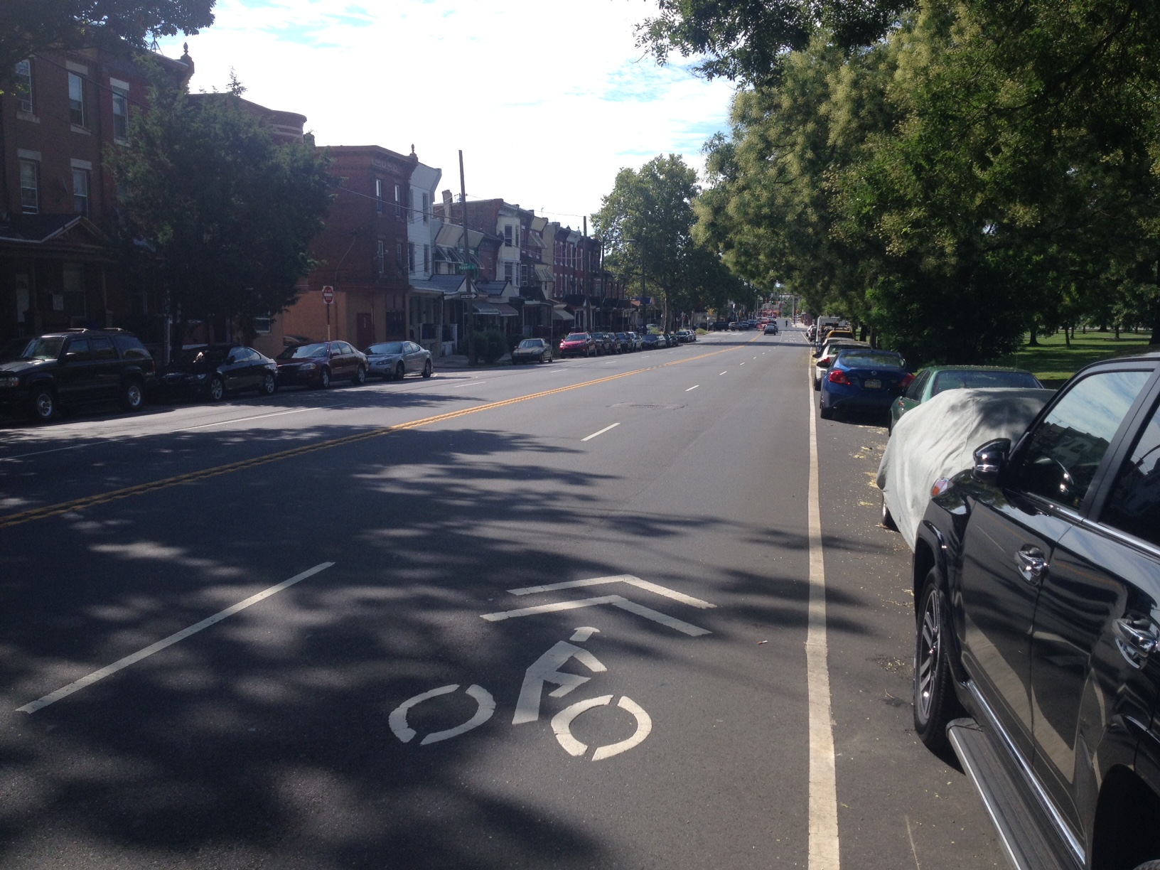
At York & Ridge, I find some sharrows, or “shared lane markings” which are meant to alert drivers of the existence of cyclists and provide a safer experience. The cars barrel through a part of Ridge that has widened from two lanes to four.
Sharrows are a strange compromise, because in failing to provide bike lanes what engineers seem to be doing is bowing to the interests of drivers, yet if cyclists were to use these markings as they were intended, the result would be worse for traffic. With two of the four lanes marked this way, just a few cyclists in each direction could tie up half of Ridge’s street space, but a protected bike lane going in both directions could be achieved with just one lane, leaving two and a turn lane for drivers– which has the same capacity as four lanes.
The failure of sharrows to achieve their goal is evident: some cyclists do take up parts of the road coming from East Falls’ pathways, but they don the MAML (Middle Aged Man in Lycra) attire that was absent on cyclists further south. At key hairpin turns, the sharrows mark lanes that cyclists avoid, keeping to the shoulder. Sometimes that shoulder disappears. Far more cyclists—and far more diverse range of them—come off the Schuylkill River Trail to catch buses at the Wissihickon Transit Center, just across from Wissihickon Park.
Welcome to Philadelphia

Where the sidewalk ends, at Northwestern Avenue and Ridge Avenue, a sign says Welcome to Philadelphia. Ridge and Henry Avenue meet near this confluence with Montgomery County and become an unusual source of hectic traffic. Just a stone’s throw from Wissihickon Park, the heat rising off of the asphalt of the roads and the big box parking lots is tremendous in contrast with the coolness of the creek valley below.
In the center median stand some gorgeous trees and bushes, and the green space that is framed by the two gigantic roads is nice, but empty. No one walks on the sidewalk on either side.
The costs of maintaining this section of road and its infrastructure are astounding: this is the reverse end of the Urban Three model, and the public expenditures necessary to create this 1960s dream are countable but hidden, like a Diagon Alley: roads many times larger than normal Philadelphia streets, land that is devoted (by zoning, not the market) to parking instead of greenspace or development, intense drainage systems that carry away the runoff during rainstorms—these are not obvious any more than the grates gasping air for the Broad-Ridge Spur are, but the attuned eye once viewing them can’t shun them from view.
Philadelphia is lucky in that this span of vast road is very small. The roadway quickly narrows back to two lanes, and the 9 bus —which doesn’t pass through most of Ridge Avenue, but turns away after the Wissihickon Transit Center to the Schuylkill Expressway—goes past areas of the city that are only modestly more suburban than its central hubs. As Philly residents start to deal with the true costs of mid-20th century planning mistakes, it will be these two lane avenues—like loose bricks in a London pub—that will make it possible to succeed.
Think diagonally.
